The fall meeting of the American Geophysical Union is in Washington, D.C., this year (Dec 10-14, 2018). The first year of NSF-Geopath funded field camp resulted in three submissions.
The first reflection on the overall success of the camp.
ED41C-1124: Using a Near Surface Geophysics and Critical Zone Science Field Experience to Broaden the Participation of Underrepresented Minorities in the Geosciences
In the United States at the undergraduate level, earth, atmosphere and ocean sciences lag behind other Science, Technology, Engineering and Mathematics (STEM) fields when it comes to the racial and ethnic diversity of students. This deficit is particularly notable for students who are underrepresented minorities (URM) in STEM fields and translates to a lag at the graduate level. Research has shown that diversity has demonstrated benefits for scientific advancement, including that diverse perspectives provide unique approaches to problem solving, which are needed to solve the complex problems we tackle in the geosciences. Using near-surface geophysics applied to critical zone science as the basis for recruiting and retaining URM students into the geosciences, we have established a program “GEOPATHS Near Surface Geophysics Field Camp Experience”.
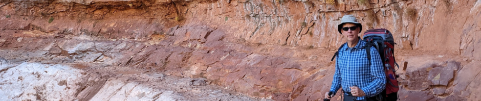
We will present findings from the first GEOPATHS field experience, which was held in the Garner Run subcatchment at the Susquehanna Shale Hills Critical Zone Observatory from 19 May to 2 June 2018. The inaugural GEOPATHS field experience had 17 student and 4 peer-mentor participants. To ensure a diverse group of participants, applicants were freshmen and sophomores drawn from 2- and 4-year colleges in the Northeast with high URM populations. The field experience was split into two sections. In the first section, students completed 4 exercises in 2-day rotations, each led by a peer mentor. Three exercises focused on geophysics including seismic refraction, electrical resistivity tomography, and ground penetrating radar; the fourth exercise was a surveying and mapping activity intended to strengthen the students’ quantitative and spatial reasoning skills. In the second section, students designed and implemented a field study using the tools they had learned. Scientific exercises were supplemented by team building activities and talks by professionals to expose students to the range of careers available in the geosciences. Over the next two years of this project, we will assess the impact that the Geopaths Near-Surface Geophysics Field Camp Experience has on broadening the diversity of geoscientists and will create a model that other institutes can use for teaching near surface geophysics to undergraduate students interested in geoscience careers.
The second and third Geopath abstract share the findings of some of the student research.
NS41B-0818: Imaging the critical zone structure using seismic refraction in Garner Run at the Susquehanna Shale Hills Critical Zone Observatory
Understanding the subsurface structure of the critical zone allows us to better understand processes such as erosion and weathering that shape landscapes and support life at the surface. Our research focused on determining the thickness of the sediment and the depth to quartzite bedrock in the Garner Run catena of the Susquehanna Shale Hills Critical Zone Observatory. During the Last Glacial Maxima, Garner Run was affected by periglacial processes even though it was not glaciated. These periglacial processes, such as freezing, thawing, and the movement of this frozen water caused sediments to be transported and deposited at Garner Run. Using a 2D seismic refraction tomography survey we imaged the subsurface seismic velocity structure. Seismic refraction surveys were oriented perpendicular to the valley axis with 2 to 3 m geophone spacing; a 280 m roll-along seismic refraction tomography survey was set up roughly parallel to the valley axis using a 4 m geophone spacing. Based on the tomographic model, we interpret three dominant layers with velocities that range from 421 to 1110 m/s, 1800 to 2500 m/s, and 3180 to to 3868 m/s. We interpret these layers as periglacial fill, fractured sandstone, and bedrock, respectively.
This research was performed as part of the 2018 Geopaths Near Surface Geophysics Field Experience program, a collaborative project between Rutgers University Newark, Temple University, Indiana University of Pennsylvania, Penn State University, and Dickinson College. The program brought together 17 freshman and sophomore undergraduate students that were guided by 4 peer mentors. Many of the students were non-geoscience majors and/or from under-represented minority backgrounds. The objective was to draw interest in the geosciences and introduce these students to basic near-surface geophysical methods.
S41B-0819: Characterizing the subsurface of the Critical Zone in the Garner Run Catchment at the Susquehanna Shale Hills Critical Zone Observatory using Electrical Resistivity
Electrical resistivity tomography data were collected in the Garner Run subcatchment of the Susquehanna Shale Hills Critical Zone Observatory (SSHCZO) from 19 May to 2 June 2018. Garner Run is a headwater subcatchment with a small stream parallel to a syncline fold axis of an erosionally resistant orthoquartzic sandstone with interbedded shale units. The surficial geology at Garner Run is largely controlled by periglacial processes, such as slumps and solifluction lobes that are associated with thawing permafrost soils. Electrical resistivity tomography data were collected to better understand the subsurface architecture and to identify variations in and delineate the depth of valley fill. The valley fill consists of poorly sorted sand to cobble size sediment that has been transported downslope. Understanding the depth and location of these deposits across the valley can be used to better constrain the geomorphological process that formed this region.
Nearly 1.6 km of electrical resistivity data with 3 m spacing were acquired with the IRIS Syscal Kid system using two array types: Wenner and Dipole-dipole. The inverted resistivity images show that there is a decrease in resistivity as surveys approach the centerline of the valley, which we hypothesize to indicate where the fill is the thickest. These data were collected as part of the 2018 Geopaths Near Surface Geophysics Field Experience, an NSF funded program aimed at introducing students typically underrepresented in STEM fields to the field of near-surface geophysics. For future studies, we will jointly interpret seismic refraction, electrical resistivity tomography, and ground penetrating radar datasets to get a complete understanding of this critical zone architecture at Garner Run.
Finally, my PhD student, Gina Pope, is presenting a poster on her research.
H51U-1598: Geophysical characterization of vacant lots to evaluate stormwater infiltration
Vacant lots have the potential to increase infiltration in urban settings, acting as ad hoc green infrastructure, but because vacant lots are heterogeneous due to urban debris and varying demolition practices, the degree of stormwater control they provide is poorly understood. Geophysical methods are a tool to characterize subsurface heterogeneity, but are also being tested as a way to study infiltration fluxes in these urban areas. Methods such as electromagnetic induction (EMI) and electrical resistivity tomography (ERT) are non-invasive, sensitive to soil heterogeneity and soil moisture content, and can be used to characterize large areas far more quickly than by using point measurements. We used EMI at a former homesite, now a vacant lot on Temple University’s Ambler campus, to select a study line that spans three zones identified in historical aerial imagery: a former driveway, remnant house foundations, and the adjacent lawn. Time-lapse ERT and EMI data were collected along this study line before, during, and after irrigation. ERT proved to be more sensitive to soil moisture fluxes in these zones than EM profiling. However, ERT surveys take longer to prepare and implement than EMI, so they are harder to scale up for monitoring large sites. Thus, there is a need to develop faster methods to monitor long-term storm water infiltration fluxes, for both wetting and drying cycles , which may require multiple surveys per day. The continuation of this study will use a permanent ERT system to monitor hourly fluctuations in infiltration at the same field site for multiple weeks. Our goal is to use these data to improve EMI survey methodology by scheduling data collection after rainfall events to coincide with peak resistivity contrasts.