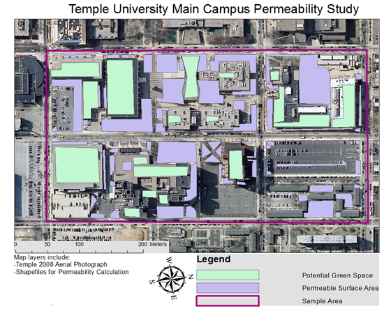
Undergraduate student's final project looking a storm water drainage on Temple's campus.
The focus of this class is on remote sensing technologies and geographic information systems. Remote sensing is a dynamic field; new, high-resolution satellites are coming on line almost daily, and there has been an exponential growth in applications of remote sensing data during the past decade, including: mineral exploration, precision agriculture, watershed management, land use classification, military intelligence, and climate monitoring. In fact, the commercial satellite data is getting so good that the American military spent a small fortune buying exclusive rights to all of the satellite data collected over Afghanistan in preparation for military operations. Now, with the introduction of Google Earth, remote sensing data in form of satellite imagery and digital terrain models are available to everyone. Every aspiring geoscientist should learn something about this rapidly expanding field. A number of students have found jobs on the basis of what they learned in this class.