
Highway I-95, the longest north-south highway in the U.S., is also one of the most heavily traveled. Love it or hate it, you’ll probably drive it at some point if you live on the East Coast. PennDOT’s 95-Revive project, a multistage, multiyear program to enhance the highway, includes improving stormwater management by installing a series of bioswales at the base of the highway where it passes through Philadelphia. Temple and Villanova Universities are assisting by studying performance and making recommendations for improvements as each new bioswale installed.

The finished bioswales are actually quite lovely — nicely landscaped urban gardens that disguise their important function — minimizing runoff by maximizing stormwater infiltration.
Modeling the hydrologic performance of these bioswales required a detailed mapping of their underlying structure. Below shows a new bioswale under construction shortly after the initial excavation.
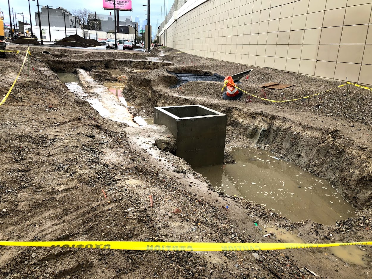
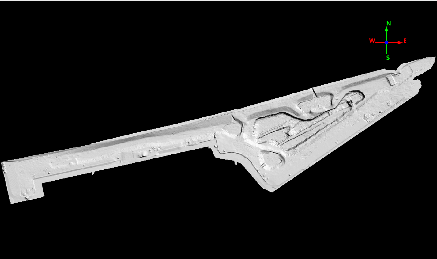
We use laser scanning (LiDAR) capture the precise geometry of this basin before it filled. The LiDAR system makes millions of precise point measurements, then takes a series of color photographs that are used to color the point cloud. The result looks like a 3D photograph.
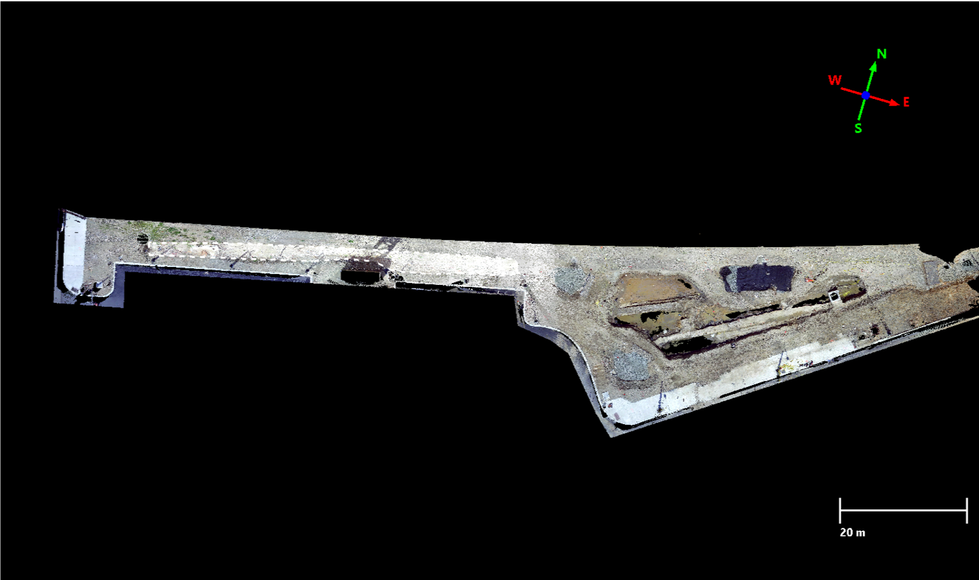
But the image can be easily rotated or translated in space to view it from any angle, and every point has a precise x, y, z coordinate associated with it. This geometry information make it possible to create detailed models of the the basis like the one below that can be incorporated in hydrologic models.
The next step at this particular basin is to scan it again after it has been filled to construct a detailed map of fill thickness and model surface topography. Then it will be scanned a third time after landscaping to obtain the positions of each and every shrub and flower planted. Such detailed monitoring can be used to answer questions such as is the basin correctly sized for the stormwater volumes it receives? Which species of plants are the are the most effective and thrive in different locations within the bioswale? How does the influx of road salt and sediment change the bioswale’s performance over time, and how much upkeep is required to maintain both the infiltration capacity and the attractive appearance?
Too often stormwater control measures are installed but their long-term performance is never evaluated. It is to PennDOTs credit that they are investing performance monitoring with an eye toward designing even better stormwater control measures for the future.