The Symposium for the Application of Geophysics to Environmental and Engineering Geophysics was held in Austin, TX this March. Good attendance and interesting talks! My presentation was on last summer’s experiment at the Shale Hills Critical Zone Observatory:
“Ground-based LiDAR mapping of infiltration and flow paths on a bedrock slope”
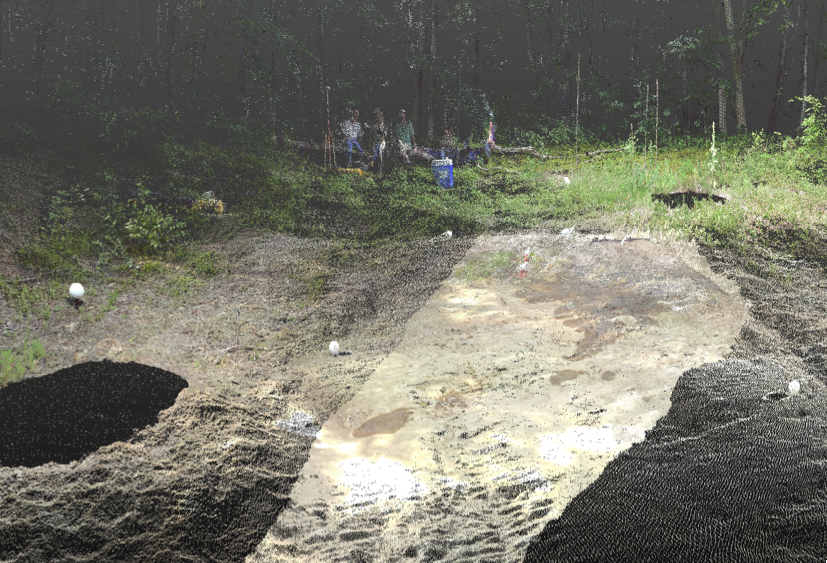
This image is part of the terrestrial LiDAR point cloud we collected at the soil borrow pit. The white spheres are targets used to stitch together the points clouds collected from different viewing angles. From the LiDAR data I created a cm-scale DEM to model flow down the hillside assuming no infiltration to compare with the observed flow after a water release from a line source visible near the top of the ridge, just below the vegetation.