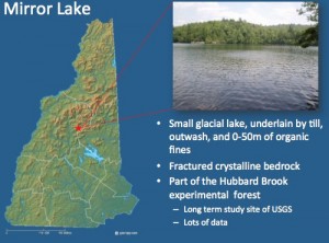
 Low seepage rates at Lake Lacawac, PA, meant that our research there did not conclusively demonstrate the utility of geophysics for mapping seepage zones. This spurred us to look for a lake known to have high seepage rates. This led us to Mirror Lake, NH, a well-studied site that is part of the Hubbard Brook Experimental Forrest. A long-term ecologic research (LTER) site funded in part by the National Science Foundation.

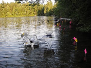
Seepage Bag Measurement Station, Mirror Lake
We spent two summers at Mirror Lake using towed and lake bottom resistivity, ground-penetrating radar shot through the bottom of a polyurethane boat, spontaneous polarization (SP) , and extensive seepage meter measurements.
The results are documented here:
Toran, L., M. Johnson, J. E. Nyquist, D. O. Rosenberry (2010) Delineating a road salt plume in lakebed sediments using electrical resistivity, piezometers, and seepage meters at Mirror Lake, NH., Geophysics, July-August.
Rosenberry, D. O., L. Toran, and J. E. Nyquist (2010), Effect of surficial disturbance on exchange between groundwater and surface water in nearshore margins, Water Resour. Res., 46, W06518, doi:10.1029/2009WR008755.
Gagliano, M., J. E. Nyquist, L. Toran, and D. O. Rosenberry (2009) Assessment of electrical resistivity method to map groundwater seepage zones in heterogeneous sediments, Proceedings of the SAGEEP ’09, Symposium for the Application of Geophysics to Environmental and Engineering Problems, 815-823, published on CDrom.
Mitchell, N., J. E. Nyquist, L. E. Toran, D. O. Rosenberry, and J. S. Mikochik (2008) Electrical resistivity as a tool for indentifying geologic heterogeneities which control seepage at Mirror Lake, NH, Proceedings of the SAGEEP ’08, Symposium for the Application of Geophysics to Environmental and Engineering Problems, 749-759, published on CDrom.
