By Vivien Wise
There are lots of reasons you might want to digitize objects from real life
- Surveying
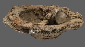
- Archaeology / conservation
- 3D modeling for games

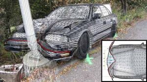
- Forensics/accident reconstruction
- 3D Printing
- Architecture
- Medical
There are two primary ways you can get the data for creating the model
Photogrammetry
Uses overlapping photos to reconstruct 3D objects
Structure Scanner + App
Laser scanner that attaches to mobiles devices (phones/iPads) to capture people, objects, and places
Here’s a quick overview of the tools and workflow needed for each
Photogrammetry
Basic Tools:
Digital Camera
Photogrammetric Software – Agisoft PhotoScan
Ways to Acquire Photos:
- Close range: Images taken from the ground
- Aerial: Images taken from above using drones, balloons, etc
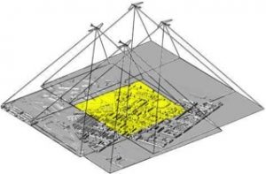
- Satellite: Images taken by satellite (Google Earth)
How to Take the Photos:
- Take photo every ~15 degrees
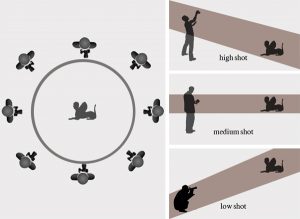
- Take photos at 3 angles (top, straight on, bottom)
- Diffused, even light with low shadows
- High aperture number (so that everything is in focus)
- Static Background
- High quality photos captured in .RAW or .TIFF is best practice
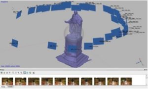
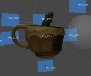
Agisoft Workflow:
Add photos: Workflow > Add photos
Align Photos: Workflow > Align photos
- Edit out any unnecessary information using masking

Build Point Cloud: Workflow > Build Point Cloud
- Clean up model at this point
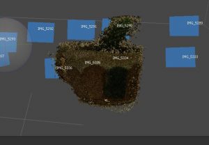
Build Mesh: Workflow > Build Mesh
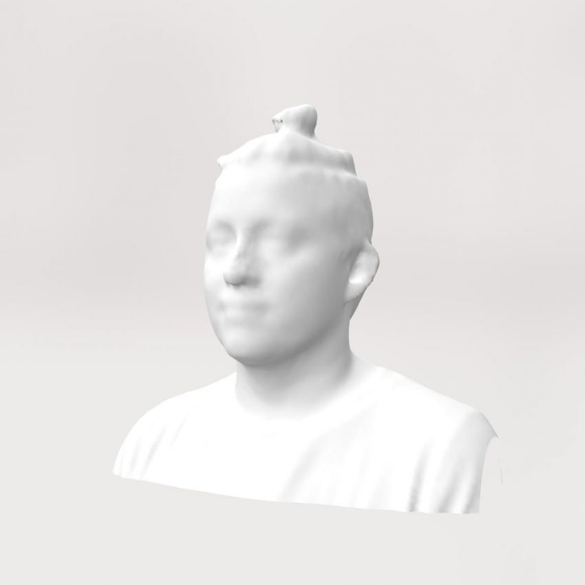
Laser Scanner | Structure Sensor
Basic Tools:
Ipad + sensor
Structure App(s)
Meshmixer (or other 3D modeling software)
How to Scan the Object:
- Calibrate sensor with Calibrator App (one time)
- Stand about 3 feet away from the object
- Position Scan Area Cube (smaller = more detail)
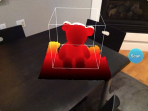
- Move around the object to capture it. Make sure to capture all angles (including undercuts)

The file is then emailed to you as an OBJ file. This can be manipulated in Meshmixer or any other 3D modeling software.
Photogrammetry or Structure Sensor 3D Scanner?
The final answer is that it will really depend on what you need the model for, but the Structure Sensor Scanner is vastly more user-friendly and quick. If you need the detail though, photogrammetry is the way to go.
Photogrammetry:
Time: takes longer to take the photos, lots of post production
Quality: Far more detail
Size: Any size object
Cost: Expensive software
*You don’t know if it will fail until after you’ve taken the photos*
Structure Sensor 3D Scanner:
Time: very fast to scan, minimal post production
Quality: less detail
Size: limited (medium-sized stuffed animal up to human bust is ideal)
Cost: Made for consumers
An interesting comparison between the two methods.
It really depends on the application and needs.
For example, game consumers have higher expectations in terms of texture quality. Therefore, leading studios thrive to achieve photorealistic models and invest in the latest photogrammetry technology like the LightStage scanning rig developed by Paul Debevec (http://gl.ict.usc.edu/lightstages/) or LightCage by ESPER (https://www.esperhq.com/product/lightcage-scanning-rig/). Although a system like this is likely to be very expensive, there is a significant reduction in scanning time and post-processing due to the fact that setups are using 100+ synchronized DSLR cameras and cross-polarised lighting. So, the subject can be scanned within milliseconds and with best resolution and accuracy that produces photorealistic textures. Unlike handheld scanners which have a limited scan quality and any movement from the subject could ruin the results.