New Publication in Applied Energy

Colocation opportunities for large solar infrastructures and agriculture in drylands in Applied Energy (Elsevier, Impact Factor: 6.5)

1-s2.0-S0306261915X00262-cov150h


http://www.sciencedirect.com/science/article/pii/S0306261915016517

Ravi, S., J. Macknick, D. Lobell, C. Field, K. Ganesan, R. Jain, M. Elchinger, and B. Stoltenberg (2016), Colocation opportunities for large solar infrastructures and agriculture in drylands, Applied Energy, 165: 383-392.


New Book Chapter

Book chapter:  Environmental Hazards, Risks, and Disasters. Elsevier

Covers hazards and disasters related to the regions of the surface and atmosphere of the Earth where living organisms exist

9780123948472

D’Odorico, P., Ravi, S., 2016. Land Degradation and Environmental Change. In: Shroder, J.F., Sivanpillai, R. (Eds.), Biological and Environmental Hazards, Risks, and Disasters. Elsevier, pp. 219–227.

9780123948472

9780123964717

492

New publication in Ecosphere

21508925-6.8.cover

Dynamic interactions of ecohydrological and biogeochemical processes in water-limited systems. (Invited)
Wang, L., S. Manzoni, S. Ravi, D. Riveros-Iregui and K. Caylor (2015), Dynamic interactions of ecohydrological and biogeochemical processes in water-limited systems, Ecosphere, 6:art133. http://dx.doi.org/10.1890/ES15-00122.1
This paper was commissioned by the members of the Editorial Board to commemorate the Ecological Society of America Centennial celebration.

Agrivoltaics

IMG_4180

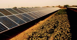
Colocation or “agrivoltaics”

Coupled solar infrastructure and agriculture could be established in marginal lands with low water use, thus minimizing the socioeconomic and environmental issues resulting from cultivation of economically important non-food crops (e.g., biofuels) in prime agricultural lands. Co-locating solar infrastructure and agriculture (including desert-adapted crops/biofuels) may provide additional benefits such as dual income streams to farmers, employment opportunities at solar facilities for crop management, options for rural electrification, and electricity for processing agriculture products locally.

NSF Funding

Awarded NSF Funding

Quantifying post-fire sediment transport and nutrient redistribution using rare earth element tracers (~400K) (PI – Sujith Ravi)

2015 – 2019

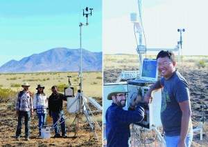
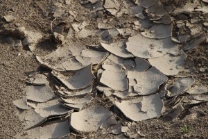
Arid and semiarid landscapes are dynamic and can undergo rapid changes in vegetation, soil composition, and topography. Some climate models indicate an increase in aridity and changes in the timing of seasonal precipitation in many semi-arid regions, including the North American deserts. This potential climate change, together with human activities, may increase the frequency and intensity of wind erosion and fire. This project will provide a quantitative assessment that examines both fire and wind erosion effects on vegetation change, soil characteristics, air quality, and landscape evolution. This study will help in the sustainable management of desert grasslands under changing climate and wildfire scenarios.

A technical description of the project

Grasslands and rangelands in arid and semi arid regions of the world, which provide fundamental ecosystem services, are undergoing rapid changes in fire activity and are highly susceptible to post-fire accelerated soil erosion and redistribution by wind. Currently, many grassland systems are being encroached by woody plants leading to decline in grass productivity with the potential to jeopardize food security and environmental quality. Even though many ecosystems worldwide exist in transition between shrublands and grasslands and are affected by episodic fires, a comprehensive understanding of the rates and patterns of post-fire wind erosion and subsequent sediment redistribution is still missing. The proposed project will quantify post-fire wind erosion and subsequent nutrient redistribution from a shrub-grass system in the Chihuahuan desert (New Mexico) using a combination of extensive manipulative field experiments, laboratory analyses and modeling. We will test the hypothesis that vegetated microsites, which capture aeolian sediments in arid landscapes, may become active sediment sources following fires. This post-fire modification of sediment sources and sinks in the landscape may impact rates of resource redistribution and soil patterning, and therefore, lead to a more homogeneous landscape and reverse grassland degradation. This project will investigate the applicability of rare earth element tracers and Unmanned Aerial Systems-based LiDAR in order to monitor landscape responses to natural and human-induced disturbances and to guide future management practices.