By Courtney Berne
Last semester, I was compiling data to track the evolution of Black-run horse stables in Philadelphia. The goal was to eventually clarify two questions.
First, has North Philadelphia’s infamous Fletcher Street always been home to horse stables? If so, why? How has this equestrian culture remained despite the land-use and socio-economic changes within Strawberry Mansion?
The second question is harder to answer. Because North Philadelphia is known as a community of Black horsemen: when did it transition from white landowners into the more diverse, multi-species refuge it is now?
In addition to seeking answers to these questions, I set out to provide a visual narrative that maps the trajectory of those who lived and worked with horses on Fletcher Street. The data revealed the most prominent horse-owners since the Civil War were the Fletcher family (1850-1901), the Lederman family (1923-1981) and the non-profit organization that has been there since 2004: the Fletcher Street Urban Riding Club (FSURC). Thus, the story map focuses on these three groups.
Because story maps are living archives, MapLibre was chosen for its flexibility and accessibility. This open-source software allows for continuous edits as the story evolves. Readers outside academia can view the contents and edit the website for free (if you opt to share login information as content collaborators). Since it was not possible to track every person’s story within the time constraints of this project, additional narratives by community members can and should be added in the future.
It Started with a Street
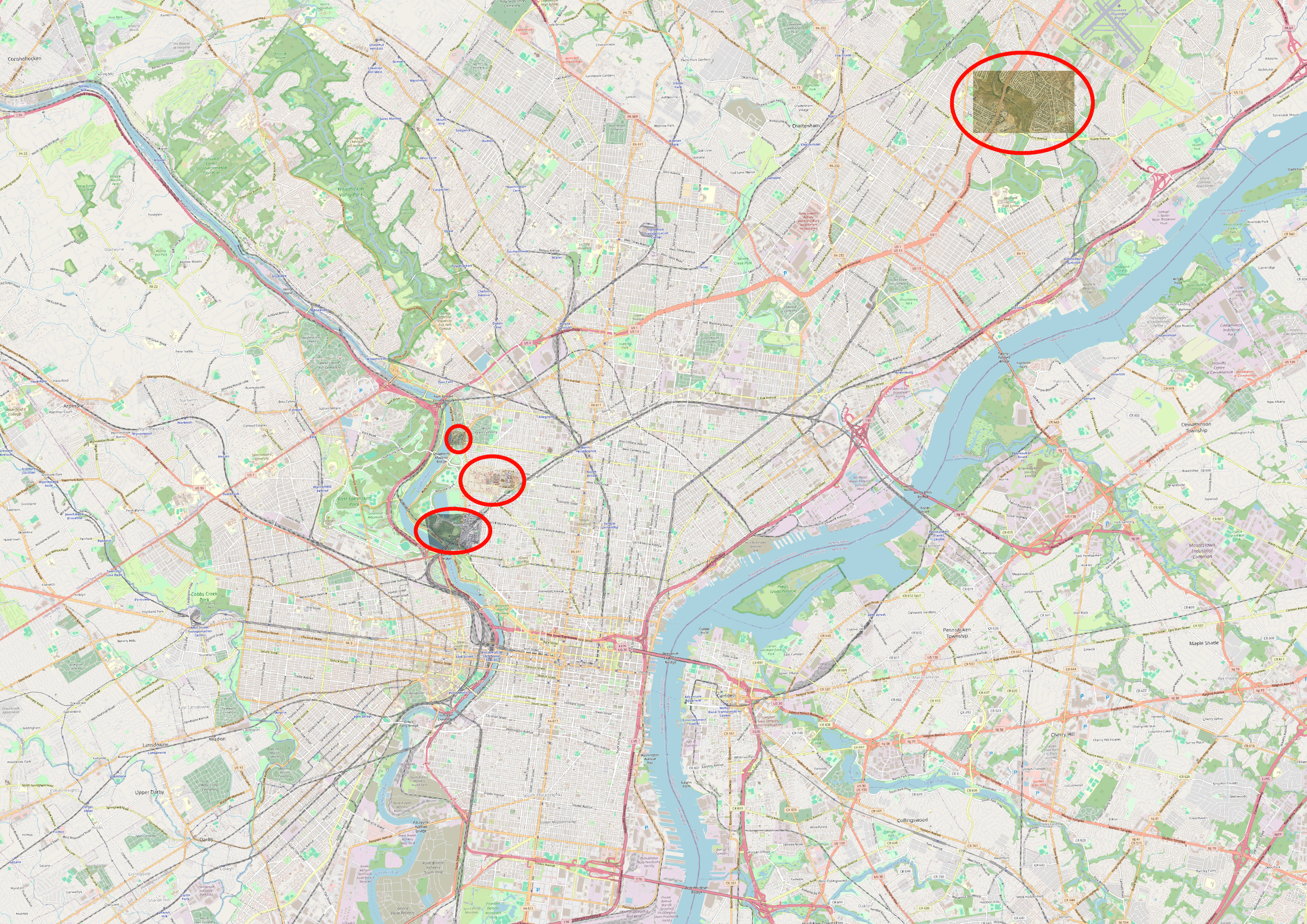
Anchoring the data in specific plots of land on West Fletcher Street helped track the proliferation and slow disappearance of stables over the 20th century. The three main areas of focus within Fletcher St were the 19th century Horse Car Depot at the corner of Ridge Ave and Susquehanna Ave, the home of the Fletcher family (2800 block), and the 2600 block of W Fletcher St. Two buildings from the mid 19th century remain at 2613 and 2603 W Fletcher St: still housing equines and horsemen.
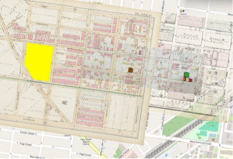
FIGURE ONE: Yellow polygon on left: Horse Car Depot (3133 Ridge Ave); brown polygon in center: former home of Fletcher family (2816 W Fletcher St); orange, green and red polygons on right, house & stables (2613-2603 W Fletcher St).
Once the timeline for the Fletcher’s was established, the Lederman’s (who occupied the house at 2613 W Fletcher St for nearly sixty years) story had to be included. Horace Lederman taught one of the eldest members of the Black riding community from North Philadelphia how to ride in the 1940s, after the neighborhood was redlined and during WWII. Few people remain who remember the Lederman’s, which is why oral histories like the one gathered by Charlie were so important during ethnographic field work.
Fletcher Street in the 21st Century
The goal of the second half of the narrative was to understand the spaces Ellis Ferrell, the President and Founder of the FSURC, occupied before he arrived on the street. This led to an abbreviated timeline of two additional locations: former stables in Pennypack Park, and stables in pre-gentrified Brewerytown.
Since neither building currently stands, I relied on the assistance of Fairmount Park Historic archivist Theresa Stuhlman to obtain an address for the Pennypack Park horse barn (geo-referencing map layers accurately requires exact addresses). The Brewerytown location could not be identified until Ellis Ferrell physically drove us to the corner of 32nd St and Master St in his red pick up truck. Once there, memories returned and he was able to not only recall the address, but to share stories about what that neighborhood was like thirty years ago.
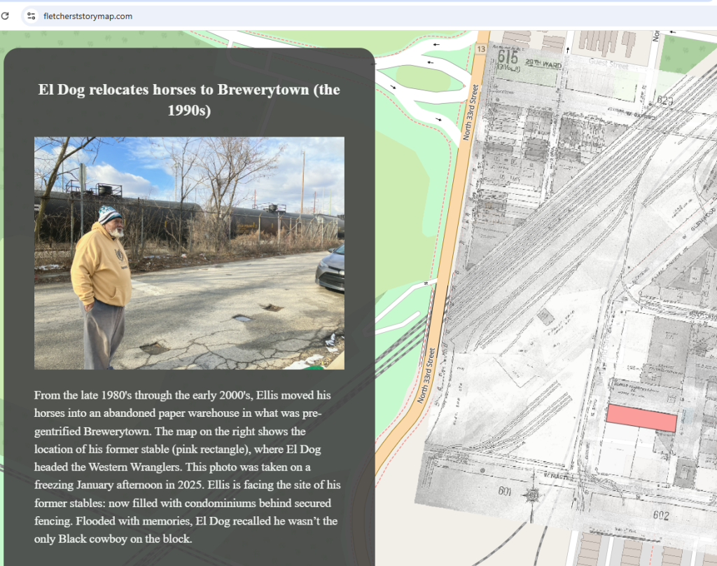
The process of geo-referencing archival maps (like the one situated on the right side of FIGURE TWO: a 1994 Sanborn fire insurance map, care of the Free Library of Philadelphia’s Map Collection) is time-intensive, but necessary in order to accurately portray the change in land use over time. Using QGIS and GitHub, additional support from GIS expert Felipe Valdez was essential in my re-learning of software I had not worked with since 2018.
Felipe created an online tutorial to guide users through the story map making process. Again, refer to his workshop here if you are inspired to create one for your own research project.
Building a Narrative
Twenty-eight map layers, spanning 149 years (1875-2024), were incorporated into our map. The final compilation allowed us to see the narrative starting from the Fletcher family (1850-1901) up until Ellis Ferrell established his non-profit (2004) and settled into his current location at 2607-11 W Fletcher Street (2014).
It’s clear from FIGURE THREE that given the breadth of time and space included in this narrative, a story map was the best medium to capture such a wide spatial and temporal journey. Using Squarespace to host our website, we settled on https://fletcherststorymap.com/ as the domain. An outline of the narrative followed. Only then did we realize that including the cemetery where the Fletcher family rests as well as the new stable (“The Cliffs”) in Fairmount Park, built in 2023 by the city for the FSURC, were essential elements of our story.
This realization mirrored the process of creating our story map, which was iterative. Every few steps forward led to a pause, and a step sideways, in order to gather more pieces of our puzzle. I knew at some point the research would have to come to a halt. And yet, this was perhaps one of the most rewarding elements of this process, aside from conducting the interviews. Each new piece of information felt like uncovering treasure, adding to the culmination of events providing answers to my initial questions.
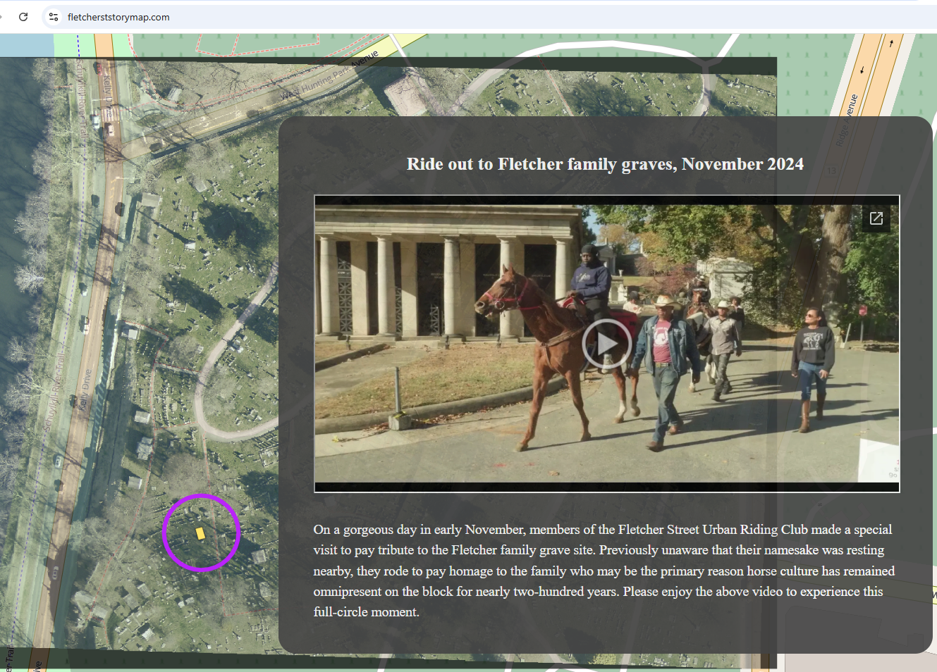
A Full Circle Moment
To conclude, I return to the beginning. Based on archival evidence, it can be said with confidence that W Fletcher Street has been home to horses since at least the Civil War. Due to the commitment of families like the Fletchers and Ledermans (see story map for more detail), at least one horse stable has remained on the 2600 block of that iconic street since the mid 19th century. Property deeds show that this area “officially” became home to Black horsemen and women in 1986, when Bertha Felder purchased the red brick barn at 2603 W Fletcher St. However, it is almost certain this has always been a multi-racial community. Today, members of the FSURC continue the legacy of horsemanship for future riders.
The video at the end of our story map shows how meaningful that legacy is. Please watch and enjoy.