I have recently began my first professional GIS position. I have taken the role of GIS Analyst at Metro Commercial Real Estate. The position requires majority of the work to be produce in ArcGIS with some Photoshop and Adobe Illustrator. Many of the maps are used for sales and strategy meetings with clients which involve site analysis, trade areas, and creating datasets. There is some work to be done in Google Earth and Placer.ai, an app which I was not very familiar to run consumer reports. Additionally, much of the work utilizes ArcGIS Business Analyst, another package which I was unfamiliar. The biggest adjustment for me in this role comes with the fast turn around for maps. Many maps are needed with fast turnaround, as sales teams and brokers are making adjustments up until the last minute. Overall, I am very excited to get involved and grow in the GIS field!
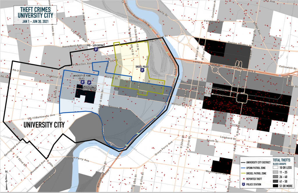
For many of the maps and images that I produce, I am bound by a disclosure agreement. However, I did recently have a small project that used open source data and standard tools found with ArcGIS and QGIS applications. The map below is similar to the original, but protects sensitive data. University City is compared with Center City Philadelphia in regards to thefts reported so far in 2021 (1/1 – 6/30).
Be First to Comment