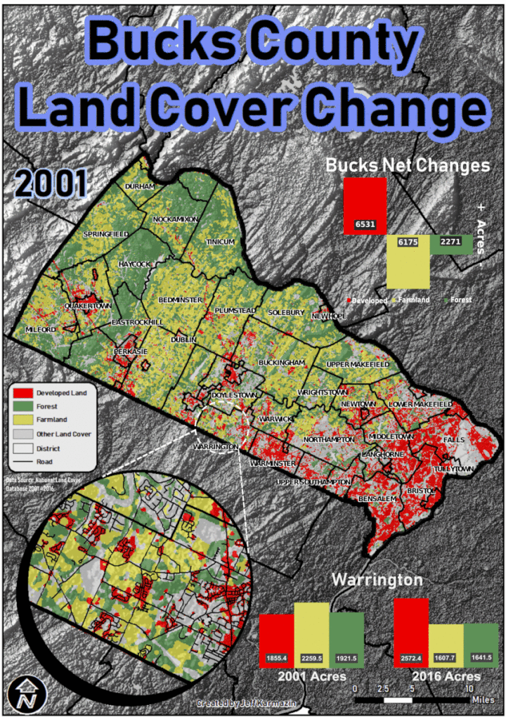
Bucks County Land Cover Change
Examining National Land Cover Database raster data from years 2001, 2006, 2011, and 2016. NLCD data is reclassified into 3 categories for analysis; Developed Land, Farmland, and Forest. Initial statistics for each category were calculated per district in Bucks County for 2001, then again for 2016. The net differences were calculated to find which districts had the biggest changes in landcover.
In the end, Warrington Township was found to have gained the most Developed Land, while losing the most Farmland and Forest. Specifically, over the 15 year period analyzed, Warrington Township gained 717 acres in Developed Land, lost 652.8 acres of Farmland, and lost 280 acres of Forest. Developed land went from 21% of the land cover in 2001 to 29% in 2016.
As for all of Bucks County, Developed Land increased by 6531 acres. Farmland decreased by 6175 acres. Forest decreased by 2271 acres.
In conclusion, it is safe to say though suburban growth has slowed since it’s explosion decades ago, the suburbs of major metro areas are still growing. Former Farmland and Forested areas provide opportunities for further expansion as our population ever increases.
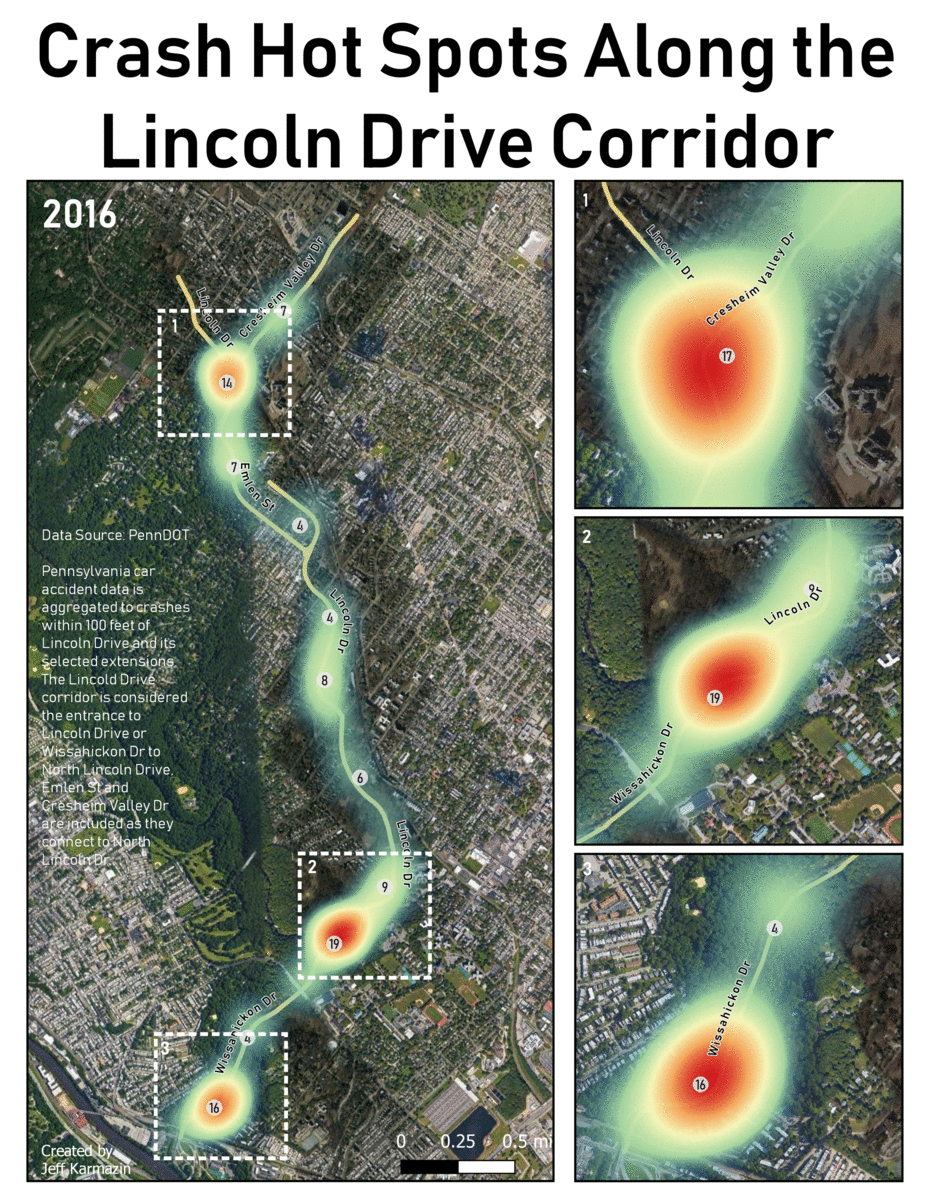
Car Accidents on the Lincoln Drive Corridor
Currently, this is preliminary analysis awaiting data for 2020 and after, so an analysis can be done to investigate the effectiveness of the Lincoln Drive Restoration Project:
As the City of Philadelphia nears the end of it’s Lincoln Drive Restoration Project, I decided to take a look at the actual car accident data that influenced a restoration in the first place.
Data from the Pennsylvania Department of Transportation was downloaded for years 2016 – 2019. These public data sets were turned into shapefiles and focused into car accidents that occurred within 100 feet of the Lincoln Drive Corridor. The Lincoln Drive Corridor is defined as the entrance to Wissahickon Drive that turns into Lincoln Drive, the Emlen Street connection to North Lincoln Drive and Cresheim Valley Drive.
The shapefiles are represented both as heat maps and point clusters.
In total from 2016 to 2019, 364 car accidents have been reported along this corridor. Three car accident hot spots are highlighted; 1. – Fork at Cresheim Valley Dr, Emlen St, and North Lincoln Dr; 2. – Most eastern curve on Lincoln Dr; 3. – Southern most curver at the entrance to Lincoln Dr.
For the future, year to year data, or 3 year averages, will be investigated to determine if the Lincoln Drive Restoration Project successfully mitigated car accidents.