Maps are geographical and artistic expressions of land and place; human judgements, attitudes, and biases are impressed onto them. I find historical maps an interesting look into the past.
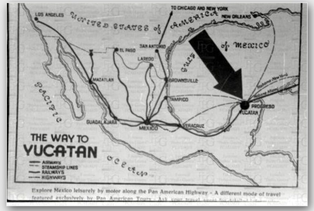
I came across this map when browsing the photo archives. It is titled “The Way to Yucatan”, and it dated to approximately 1940-1950. It depicts the routes connecting Mexico to the southern parts of the United States. There are many forks in the northern routes, and they all end in the Yucatan Peninsula. Additionally, the map seems to be illustrated for use by tourists, indicated by the playful fonts and the easy-to-read key. The information laid out in this map are straight forwardly presented, with little to no additional information. The key tells the reader various routes to take to the Yucatan, by 4 different means of transportation: airways, steamship, railways, and highways. Under the map, in English, readers are encouraged to “Explore Mexico leisurely by motor along the Pan American Highway…”
This map is an example of the early marketing of Yucatan and Mexico to tourists. It displays the entitlement that Americans felt/feel towards Mexico and the Yucatan, and how Mexico was/is catered towards tourists. All of the cities marked are on the coast, the most desirable cities as tourist destinations. The language being in exclusively English implies exclusion of certain demographics from engaging in this sort of touristic relationship with Mexico. The lack of markers for anything other than tourist locations along the routes erases the people permanently all across Mexico, as well as the cultural significance of the land that is being commodified in this map. Finally, Mexico is presented as monolith in this map, with the borders between the different Mexican states not being depicted.
I enjoyed being able to look at this map and attempt to analyze the different implicit and explicit beliefs and attitudes being expressed.